
TROPICS GUIDE
What Is an Invest? NHC's Formation Odds Before a Gulf Storm Has a Name
Invest, tropical depression, or Potential Tropical Cyclone: what the National Hurricane Center's formation odds mean, and what to do on the Gulf Coast before a storm has a name.
An invest is a research designation
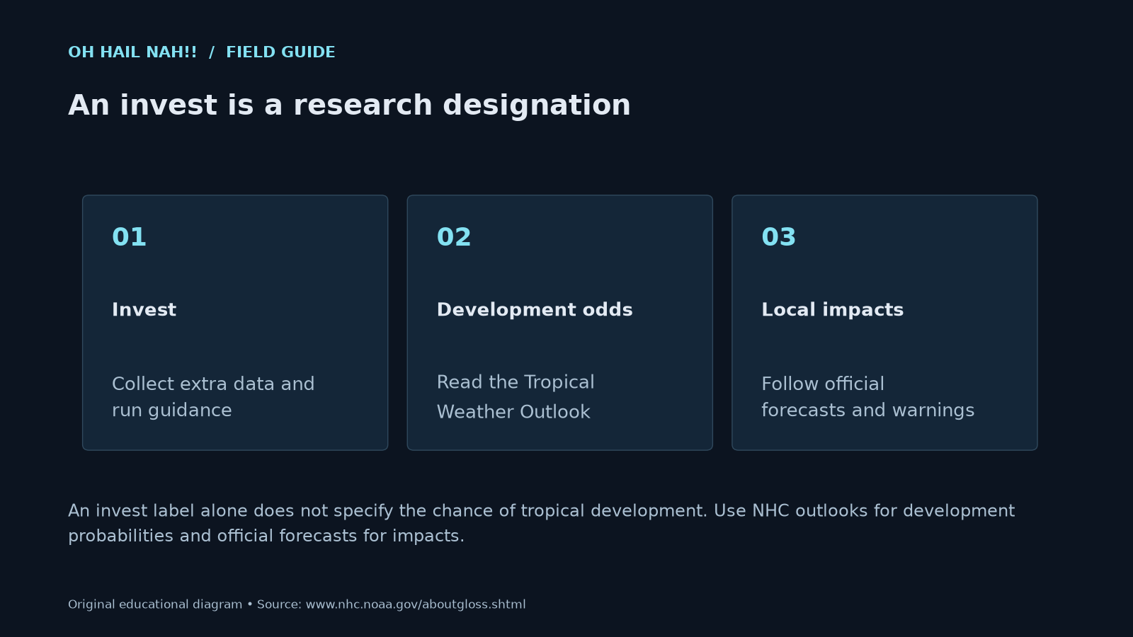
An invest label alone does not specify the chance of tropical development. Use NHC outlooks for development probabilities and official forecasts for impacts.
The short answer
An invest is a weather system the National Hurricane Center has flagged for extra data collection and computer modeling. It is not a storm yet. NHC's formation chance is its forecast that a tropical cyclone forms within 48 hours or 7 days. It does not tell you strength, track, or impacts for your town.
Right now (updated 10:25 AM CT Sun Oct 11): Isaias is post-tropical
The National Hurricane Center issued its final advisory on Isaias (#15) at 4 AM CDT Sat Oct 10, after Isaias made landfall near Destin, FL, as a hurricane Friday evening, and handed the system to the Weather Prediction Center. WPC issued its own last advisory (#20) at 10 AM CDT today: the leftover low was about 180 miles northeast of Nashville, TN, moving east-northeast at 22 mph with 25 mph winds, and is forecast to dissipate over West Virginia this evening. Flood Watches remain for parts of the Central and Southern Appalachians, with 1 to 3 more inches of rain possible from the Central Appalachians into the Mid-Atlantic and river flooding continuing in western North Carolina. From here, get updates from your local National Weather Service office, and never drive into a flooded road.
- WPC final advisory on Isaias
- WPC rainfall and flash flood outlooks
- NHC Isaias advisory archive
- Your local NWS office
How this ties to the guide: Isaias began as invest AL92 in the southwestern Gulf, became Tropical Depression Nine on Oct 6, then Tropical Storm Isaias and Hurricane Isaias, the same path explained below.
What is an invest?
"Invest" is short for investigation. NHC's glossary defines it as a weather system that a tropical cyclone forecast center "is interested in collecting specialized data sets (e.g., microwave imagery) and/or running model guidance" on. Once a system becomes an invest, extra satellite products and model runs start showing up for it online. That is why your timeline fills up with spaghetti plots the moment a number appears.
The most important line in that definition is this one: being labeled an invest "does not correspond to any particular likelihood of development." An invest is a label for paperwork and data, not a forecast. For the odds, NHC points you to the Tropical Weather Outlook.
In NHC's outlook text, an Atlantic invest shows up with a code like AL92. The "AL" means Atlantic. Online and on streams you will often hear it called Invest 92L.
What does a 90 percent formation chance actually mean?
The Tropical Weather Outlook gives each disturbance two numbers: the chance a tropical cyclone forms within 48 hours, and the chance it forms within 7 days. NHC rounds both to the nearest 10 percent and labels them:
| NHC category | Formation chance |
|---|---|
| Low | 0–30% |
| Medium | 40–60% |
| High | 70–100% |
Source: NHC product descriptions.
So "90 percent" means NHC forecasters think it is very likely the system becomes a tropical depression or stronger in that time window. Here is what it does not mean:
- Not a 90% chance it hits you. The number is about the system forming, not about where it goes.
- Not a strength forecast. A 90% system might form as a weak depression or become a hurricane. The outlook does not say which.
- Not a rain or wind forecast for your town. Heavy rain and gusty wind can arrive whether or not a named storm forms.
The outlook also comes with a map. The shaded area is where a cyclone could form, not a forecast track or a cone. Cones only appear once NHC starts issuing advisories.
The Atlantic outlook comes out every six hours during hurricane season (May 15–Nov 30 for the outlook product): 1 a.m., 7 a.m., 1 p.m. and 7 p.m. Central Daylight Time. NHC can also issue a Special Tropical Weather Outlook between those times, for example after a recon flight.
What's the difference between a tropical depression, a tropical storm, and a hurricane?
Once a system has a closed circulation and organized thunderstorms, NHC calls it a tropical cyclone. Then wind speed decides the label. NHC uses the highest one-minute average wind, called the maximum sustained wind:
| Stage | Max sustained wind | Name? |
|---|---|---|
| Tropical depression | 38 mph or less | Number only (for example, "Tropical Depression Fifteen") |
| Tropical storm | 39–73 mph | Gets a name |
| Hurricane | 74 mph or more | Keeps its name; Category 1–5 |
What is a Potential Tropical Cyclone advisory?
This is the stage that matters most for the Gulf Coast, and it's the one people know least.
NHC defines a Potential Tropical Cyclone (PTC) as "a disturbance that is not yet a tropical cyclone, but which poses the threat of bringing tropical storm or hurricane conditions to land areas within 72 hours."
Put simply, if a system is close enough to land and NHC expects it to become a storm, NHC does not wait for it to finish organizing. It starts full advisories early so tropical storm, hurricane, and storm surge watches and warnings can be issued before the system technically qualifies. The National Weather Service says the same thing: these alerts "can be issued for storms that the NWS believes will become tropical cyclones but have not yet attained all of the characteristics of a tropical cyclone."
When a PTC advisory starts, you get the same products as a named storm: a public advisory, forecast discussion, a track cone, and wind speed probabilities. That means a PTC can bring a watch or warning to your coast even though the storm has no name yet. Treat a PTC watch or warning exactly like one for a named storm.
Why does NHC send hurricane hunters to a system that isn't a storm yet?
Satellites can show thunderstorms, but they can't always tell whether there is a closed circulation at the surface or how strong the winds are. Aircraft can measure that directly. NOAA's jet samples the environment around the system, the air it is moving through. An Air Force reconnaissance plane flies into the disturbance itself to look for a center. NHC's glossary lists recon aircraft as one way it fixes a storm's center. NHC can also put out a Special Tropical Weather Outlook between scheduled ones to share what recon found.
What should Gulf Coast residents do while it's still an invest?
Keep it calm and simple. The invest stage is your quiet prep window:
- Check the official outlook twice a day at nhc.noaa.gov, not screenshots of single model runs.
- Know your evacuation zone from your county or parish emergency management office. Evacuation decisions are mostly about water, not wind.
- Top off the basics: medications, fuel, cash, phone chargers, and a way to get alerts if the power goes out (see alerts that wake you up).
- Watch for the switch to advisories. When NHC starts "Potential Tropical Cyclone" or "Tropical Depression" advisories, read the Key Messages and your local NWS office's Hurricane Local Statement.
- Follow local officials. NOAA notes that evacuation orders can be issued before watches or warnings are posted.
Sharing a single model run as a forecast causes more panic than it helps. The outlook and the advisories are the forecast.
Questions people ask
What is an invest in hurricane season? An invest is a disturbance the National Hurricane Center has tagged for extra data collection and model runs. NHC says the label itself does not indicate how likely the system is to develop. Check the Tropical Weather Outlook for the formation chance.
What does Invest 92L mean? It is the label for an Atlantic-basin system NHC is investigating. In NHC's own text it appears as AL92. The number is a tracking ID, not a ranking of strength or threat.
What does a 90 percent formation chance mean? NHC thinks it is very likely a tropical depression or stronger forms within the stated window (48 hours or 7 days). It is not the chance the system hits a specific place, and it says nothing about how strong it will be.
What is a Potential Tropical Cyclone? It is a disturbance that is not yet a tropical cyclone but could bring tropical storm or hurricane conditions to land within 72 hours. NHC starts advisories early so watches and warnings can go up in time.
Can there be a hurricane warning before a storm is named? Yes. The National Weather Service can issue tropical storm, hurricane, and storm surge watches and warnings for a Potential Tropical Cyclone. Treat them the same as warnings for a named storm.
How often does NHC update the tropical outlook? Every six hours during the season: 1 a.m., 7 a.m., 1 p.m. and 7 p.m. Central Daylight Time. Special outlooks can be issued in between when something important changes.
Get ready, then keep watching
When the tropics heat up, we're watching too. You can watch the rain bands on radar, and our storm kit checklist covers what to keep ready before a storm.
This guide supports personal planning. It does not replace official advisories, warnings, or local evacuation orders. When a watch or warning is in effect for you, act on it first. Official forecasts: nhc.noaa.gov and weather.gov.
Keep reading
- Excessive Rainfall Outlook levels, explained: tropical rain risk before any watch exists.
- Flash Flood Emergency vs. Flash Flood Warning: when tropical rain turns dangerous inland.
- Interactive weather radar: watch the system's rain bands come ashore.
Sources
- NHC, Atlantic Tropical Weather Outlook, 200 PM EDT Tue Oct 6 2026 (fetched 1:19 PM CDT)
- NHC, Active tropical cyclones (fetched 1:19 PM CDT Oct 6, 2026)
- NHC, Glossary (Invest, Potential Tropical Cyclone, Tropical Depression, Tropical Storm, Hurricane, Advisory)
- NHC, Product descriptions (outlook probability categories, issuance times, Special Tropical Weather Outlook, PTC advisories)
- NWS, Hurricane and Tropical Storm Watches, Warnings, Advisories and Outlooks
- NOAA, Hurricanes resource collection
